Virtual tours, 360 and spatial 180 immersive content
Virtually done
Our expertise in immersive virtual content in Japan
- •360 VR promotional videos, 360 photos
- •180 VR spatial video
- •Matterport tours of real estate
- •360 panorama photo virtual tours
- •Photogrammetry and LiDAR mapping
360 VR promotional videos
We have designed and produced a range of 360 VR immersive videos, including for the United Nations and local authorities in Japan.
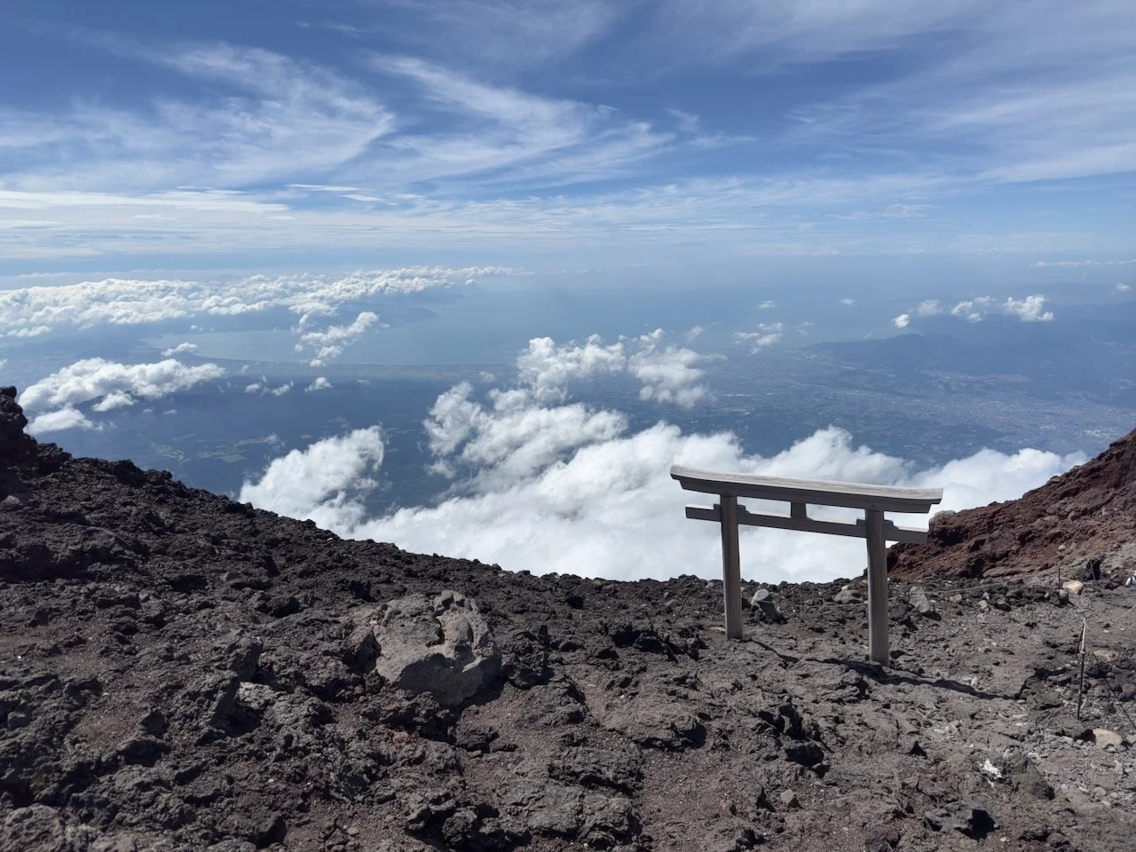
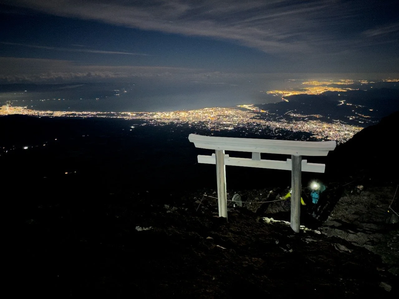
Our most recent 360 tour is this one of the climb up Mt Fuji on the Fujinomiya Route, including cultural and historical locations at the base of Mt Fuji.
国連や地方自治体向けに、様々な360度VR動画実績はあります。最新の360度ツアーでは、富士山の富士宮ルートを登りながら、山麓の文化的および歴史的な場所を紹介しています。日本語ナレーション版はこちら。
360 VR tour of the climb up Mt Fuji
360 VR promotional photos
360 VR photo of Mt Fuji taken by drone from Lake Kawaguchi
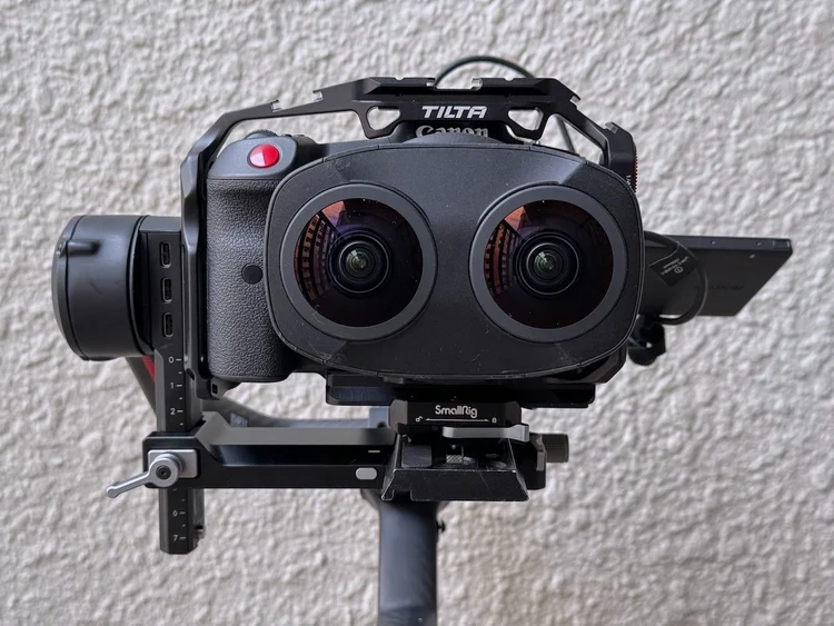
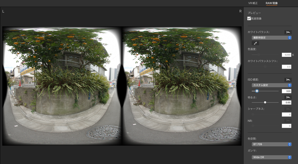
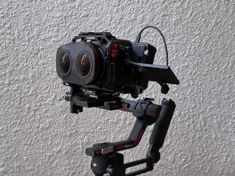
180 VR spatial video
With our Canon RC5 and the Canon RF5.2mm F2.8 L dual fisheye lens we are able to film VR 180 spatial video
Matterport tours of real estate
As part of our comprehensive real estate photo and video promotion services, we have made Matterport tours of real estate properties in Japan with the Matterport Pro3 3D camera. An example of a Matterport 3D virtual tour below. More information on how we can showcase your commercial real estate assets on our corporate filming site, Filming in Japan.
商業用不動産を中心にMatterport 3D ツアーの実績あります。Matterportツアーの詳細については企業映像専用サイトへ。
Yoyogi 5 Chome — Matterport 3D virtual tour
360 panorama photo interactive tours
We have designed and produced 360 virtual immersive tours of commercial properties, public spaces and national parks in Japan.
Examples of 360 panorama photo tours for commercial real estate on our corporate video site here.
国内の国立公園などの360度バーチャルツアーを設計し、制作した実績はあります。
また、倉庫などの商業施設で360度ツアーの実績は企業映像の専用サイトへ。
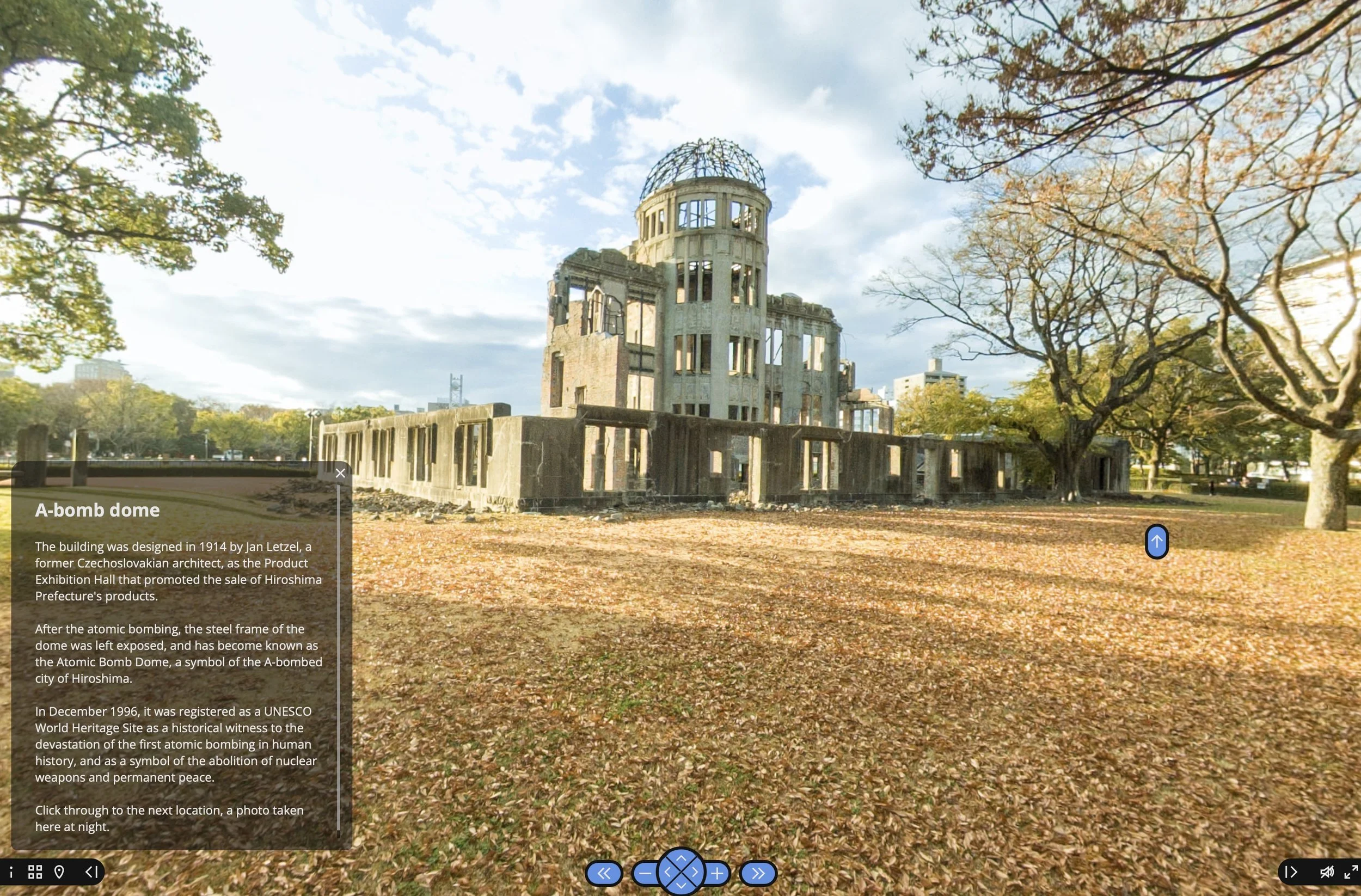
Interactive tour of the Hiroshima Peace Park
広島平和公園の体験型バーチャルツアー
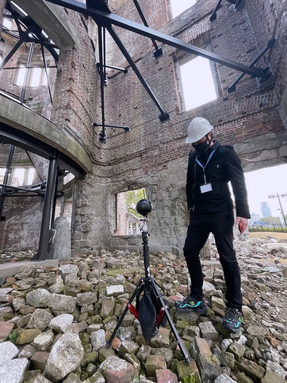
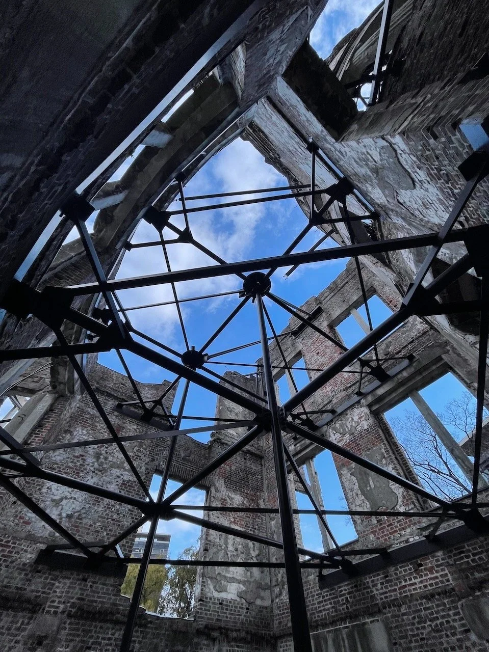
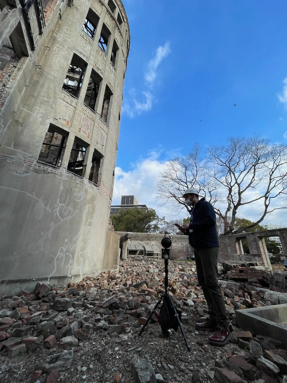
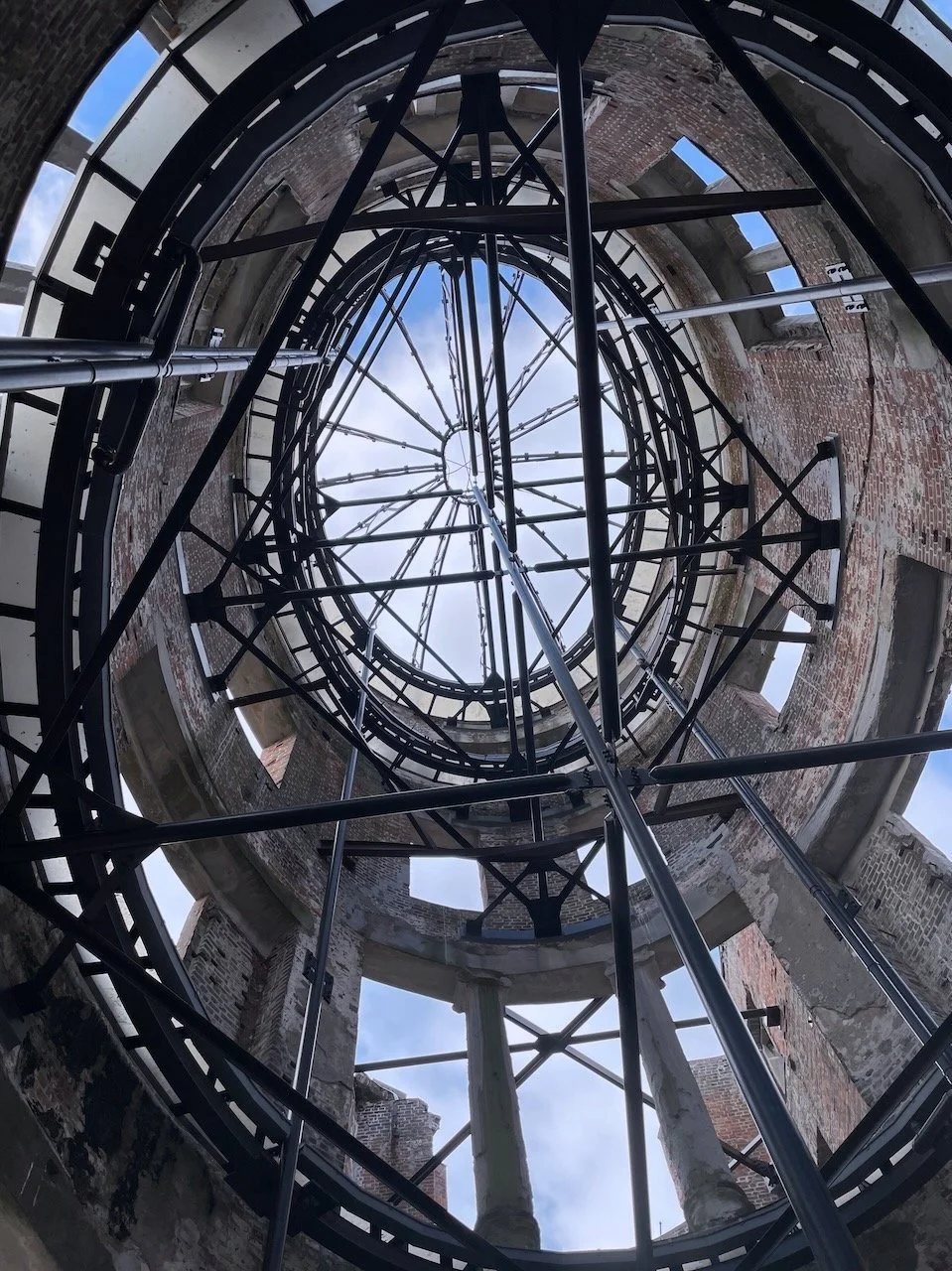
We designed and produced an educational interactive tour of the Hiroshima Peace Park, including a 360 tour of the normally off-limits interior of the A-bomb dome written up on the blog here, for the United Nations training entity, UNITAR.
普段立ち入り禁止の原爆ドーム敷地内も含めた広島平和記念公園全体を体験できる360ツアーを設計し、制作しました。広島平和記念公園のバーチャルツアー撮影現場がNHK広島とRCC広島放送で取り上げられた。
Click through for a 360 virtual tour of the Hiroshima Peace Park
Interactive 360 panorama tour of Mt Fuji
富士山の下山・登山体験型バーチャルツアー
We designed and photographed an interactive 360 panorama tour of Mt Fuji for Fujinomiya City, introducing the cultural history of the climb through locations around the base of Mt Fuji, and also an immersive experience of climbing Mt Fuji.
富士登山信仰の歴史と文化を紹介しながら、登山体験ができるインタラクティブな360度パノラマツアーを設計し、撮影しました。
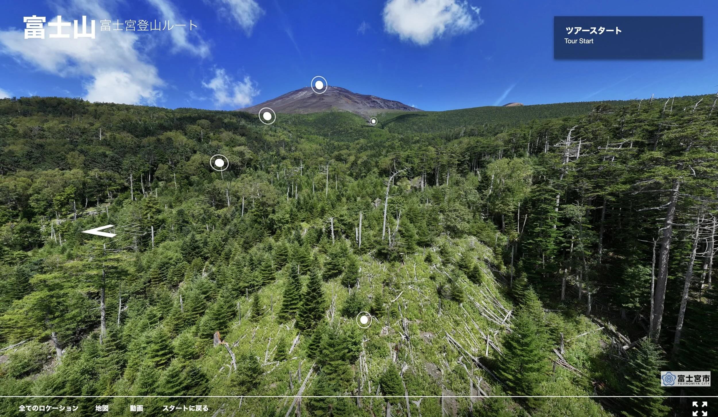
Click through for a 360 virtual tour of climbing Mt Fuji
photogrammetry, LiDAR mapping
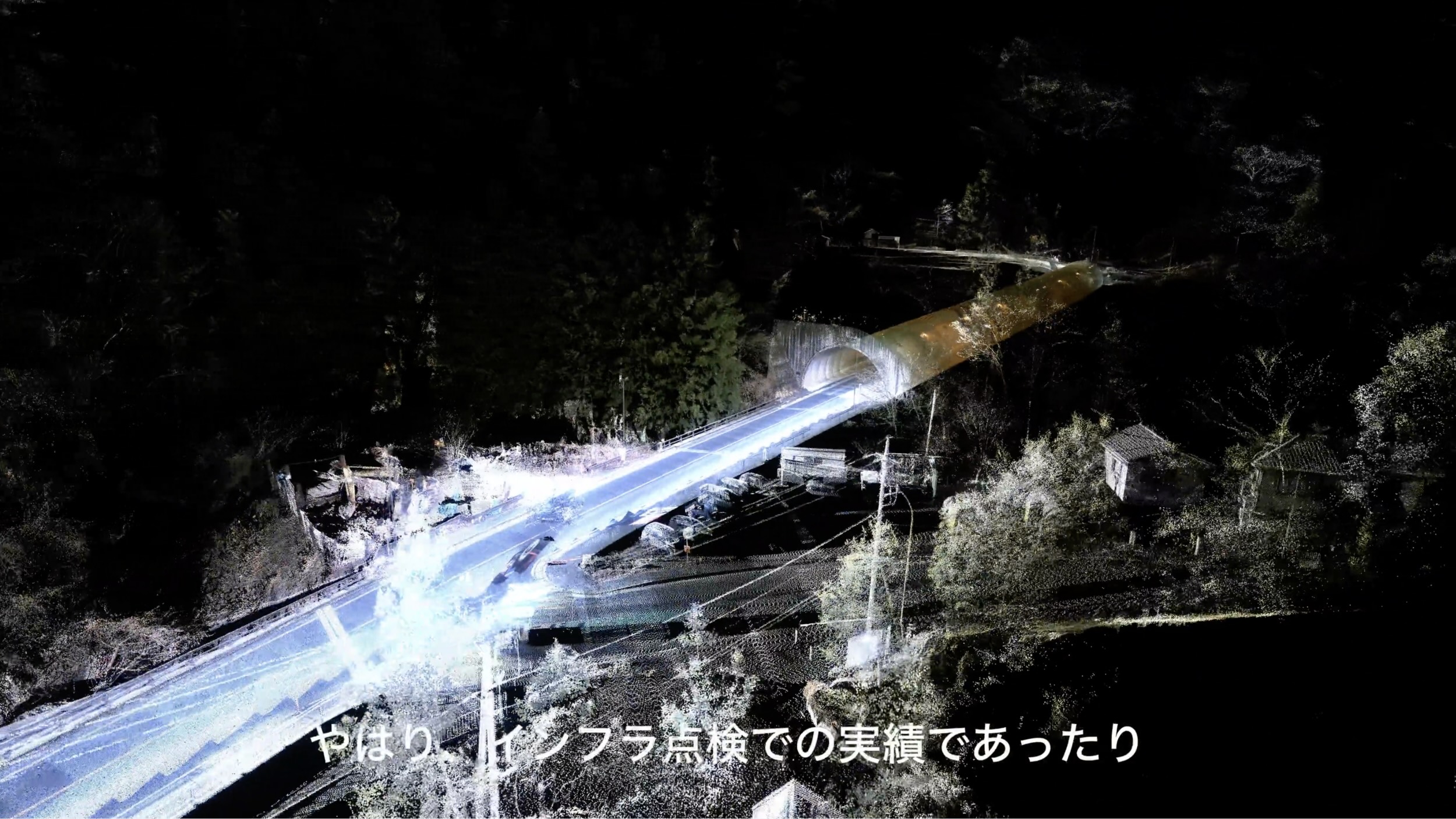
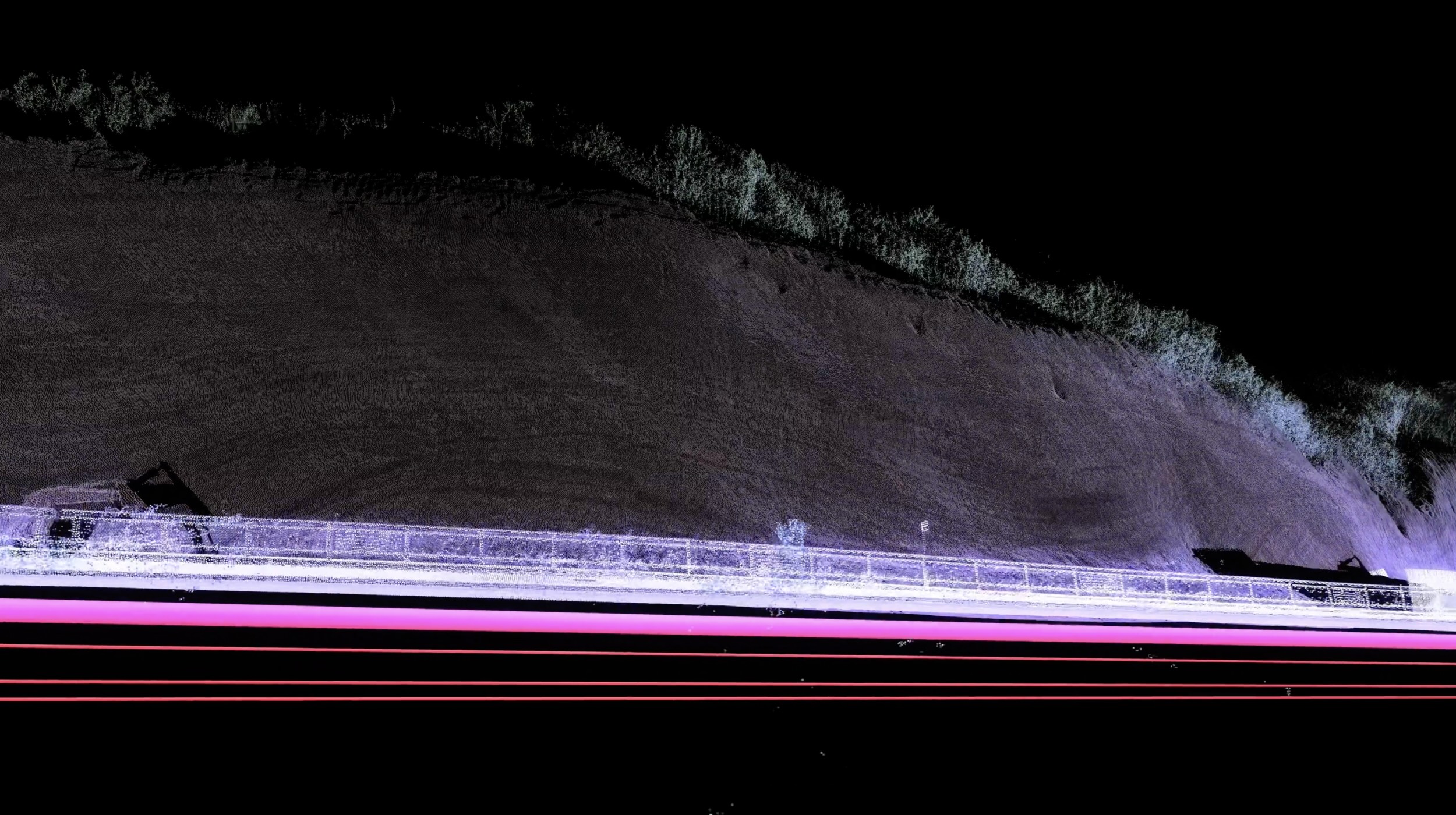
We can use LiDAR or photogrammetry to make point cloud data of a real location that then can be manipulated as the beach side shrine example above, or layered over a location to analyze and explain, as the screenshots from the promotion video for a infrastructure inspection service, below
We partnered with Imgee on a customer testimonial project to showcase how photogrammetry can be used for infrastructure inspection work. Click the screenshots below for the full video.
LiDARやフォトグラメトリー(あるいはその併用)を使ってリアル3Dモデル(3D点群)を作成すれば表現力の幅が広がる。
次のスクリーンショットをクリックするとImgeeと組んで制作したインフラ点検システムのPR映像がみられます。